Map Design Guide
I spend a lot of time designing and making my own maps, and I’ve started to teach more people how to do the same. I also care that people are learning how to make maps that are informative and serve a purpose.
In 2018, I worked with a group of other researchers at the Voting Rights Data Institute to put together an introductory-level map design guide to help us with our own teaching.
See the full guide here.
It was initially intended for people familiar with general data analaysis without a cartography background, but I hope everyone can learn something from it! It focuses on static thematic maps, but there’s a short section on interactivity at the end. Much of the material has been sourced from a combination of our own experiences and other resources already written. We owe many thanks to the Axis Maps cartography guides.
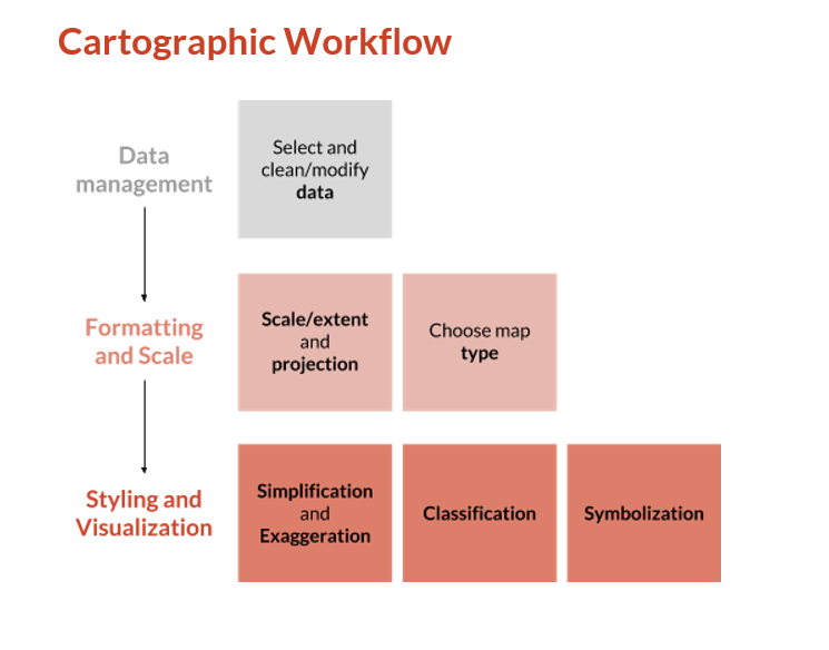
Included are sections on map types, projections, classification schemes, typography, color choices, and much much more! There’s also an emphasis on how to implement these principles in Python using geopandas. We also lay out what we think is a good general workflow for people new to GIS and cartography.